
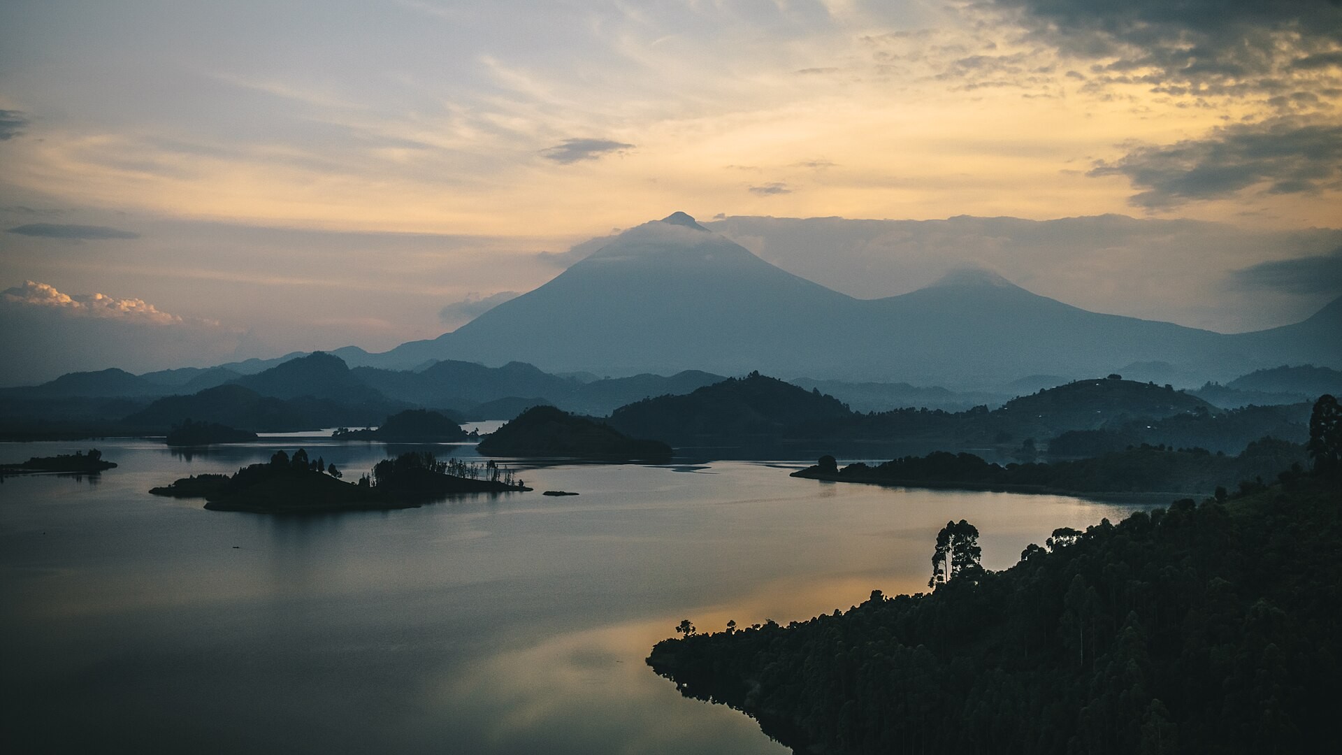
Lake Kivu is a meromictic rift lake in the Albertine Rift, the western branch of the East African Rift System, straddling the border between the Democratic Republic of the Congo to the west and Rwanda to the east. It covers 2,700 km² at an elevation of 1.5 km, with a shoreline of 860 km, a length of 97 km, and a maximum width of 48 km. Permanently stratified deep waters, isolated from the upper layers by dissolved gases and saline geothermal groundwater, set it apart from most other African Great Lakes and make it one of only three lakes on Earth capable of a limnic eruption. Those same deep waters hold enough dissolved methane to supply a growing energy industry, and the fishery around the lake supports approximately 500,000 people in Rwanda and the DRC.
Key facts
- Country: Democratic Republic of the Congo; Rwanda
- Type: meromictic lake; lake
- Located in: city hall
- Coordinates: -1.8531, 29.1353
- Area: 2,700 km²
- Elevation: 1.5 km
Physical character
Approximately 58 percent of Lake Kivu’s total surface area, spanning 1,370 km², falls within the DRC’s borders; the remaining 42 percent lies in Rwanda. The drainage basin covers 5,097 km². Runoff from the lake exits southward through the Ruzizi River, which carries its waters into Lake Tanganyika.
The lake’s permanent stratification is what makes it meromictic. Deep water (the monimolimnion) sits isolated from the circulating surface layer (the mixolimnion) because dissolved gases and the steady influx of saline geothermal groundwater create density differences strong enough to resist seasonal mixing. This isolation allows gas concentrations to build up over geological timescales rather than being dispersed.
An island system of approximately 150 islands, most of them uninhabited, is concentrated in the southern and central portions of the lake near Karongi (Kibuye) on the Rwandan side. Idjwi Island, lying within the DRC, is the largest, with a population of around 260,000 people.
Formation and geological setting
The Virunga volcanic chain, eight major volcanoes including the active Nyiragongo and Nyamuragira, borders Lake Kivu’s northern shore and has shaped the lake’s formation, chemistry, and ongoing geothermal activity from the outset. Around 10,000 to 13,000 years ago, volcanic eruptions permanently blocked the lake’s original northern outlet, diverting its drainage southward into the Ruzizi River. Before that damming event, Kivu drained northward, ultimately toward the White Nile basin.
Geothermal groundwater still seeps through the lake bed, carrying dissolved salts that reinforce the density barrier between deep and surface waters. Mount Nyiragongo’s summit reaches approximately 3,470 meters (11,380 feet), almost exactly 2,000 meters above the lake surface. On January 17, 2002, Nyiragongo erupted and sent lava flows through the city of Goma, killing at least 147 people, displacing approximately 400,000, and pushing lava into Lake Kivu, where it created a new delta on the lake bed.
Gas hazard and scientific study
Lake Kivu is one of only three lakes in the world known to be capable of a limnic eruption, an event in which dissolved carbon dioxide escapes suddenly from deep water. The other two are Lake Nyos and Lake Monoun, both in Cameroon. Dissolved gas concentrations were first recorded scientifically in 1935 by Damas, who measured carbon dioxide and hydrogen sulfide in the lake’s deep water.
A 2020 intercomparison study drew on dissolved gas measurements conducted in March 2018 and concluded that methane and carbon dioxide concentrations were close to a steady state, with no evidence of increasing eruption risk from gas buildup alone. That finding does not eliminate the hazard; volcanic or seismic disturbance could still trigger a release independent of the slow accumulation of gas.
Energy extraction
Industrial use of the lake’s gas began in 1963, when Union Chimique de Belge started extracting purified methane at a pilot plant in Rubona. That experiment demonstrated that gas could be drawn from the deep water economically, though large-scale generation remained decades away.
Since 2016, the KivuWatt facility managed by ContourGlobal has been extracting biomethane from the lake and generating 26 MW of electricity, representing approximately 30 percent of Rwanda’s energy capacity at that time. The plant is a floating structure, one of very few floating commercial power stations in the world run on lake gas. Since its commissioning it has generated nearly 2 TWh of electricity. The methane in the lake has been estimated to be worth up to US$42 billion over 50 years.
Ecology and fishery
The lake holds approximately 28 fish species, of which around 50 percent are endemic cichlids. The fishery they support is substantial: approximately 500,000 people in Rwanda and the DRC depend on it for their livelihoods. Unusually for a large African lake, Kivu is free from crocodiles and hippopotamuses and carries no bilharzia risk, which makes open-water swimming relatively safe.
Most of the lake’s roughly 150 islands are uninhabited. The populated exception is Idjwi Island, where around 260,000 people live without an electricity grid, with daily life centred on fishing and subsistence farming.
Tourism and access
The Congo Nile Trail, a 227 km hiking and cycling route along the Rwandan shore, runs from Rubavu (Gisenyi) in the north to Rusizi (Cyangugu) in the south. Developed in 2009, it is one of Rwanda’s flagship adventure tourism routes. The trail passes through lakeshore hills, fishing villages, and tea estates along the same corridor that separates the Congo basin from the Nile watershed.
Did you know
- Before volcanic damming around 10,000–13,000 years ago, Lake Kivu drained northward toward the White Nile. The same eruptions that blocked that outlet redirected the lake’s flow completely southward through the Ruzizi River into Lake Tanganyika, a full reversal of its original drainage direction. (gorillasafarirwanda.net)
- The methane dissolved in Lake Kivu has been estimated to be worth up to US$42 billion over 50 years, making it one of the most economically valuable natural gas reserves held in a freshwater body anywhere on Earth. (nature.com)
- The KivuWatt electricity plant, commissioned in 2016 and credited with generating nearly 2 TWh of electricity, is a floating power station. It is one of very few floating commercial power plants in the world operating on gas extracted from a lake. (contourglobal.com)
- Idjwi Island sits in one of Central Africa’s most conflict-affected regions, yet its isolation in Lake Kivu has historically shielded it from the wider Kivu conflict. Around 260,000 people live on the island with no electricity grid; fishing and subsistence farming structure daily life. (fairobserver.com)
- Lake Kivu has no crocodiles, no hippopotamuses, and carries no bilharzia risk, placing it among the very few large African lakes where open-water swimming is considered safe. (lakepedia.com)
- Mount Nyiragongo’s summit reaches approximately 3,470 meters (11,380 feet) above sea level, which puts it almost exactly 2,000 meters above the surface of Lake Kivu itself. (science.nasa.gov)
Data sources
- Wikidata
- agl-acare.org
- gorillasafarirwanda.net
- ncbi.nlm.nih.gov
- pubs.usgs.gov
- studyguides.com
- volcanosatlas.com
- dlapiperafrica.com
- contourglobal.com
- carhire4x4drive.com
- exploretraveloasis.com
Data updated: 2026-11-01