
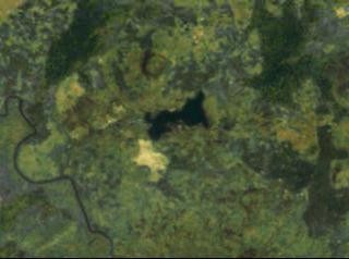
Lake Monoun is a maar-type volcanic crater lake in the Noun Division of Cameroon’s West Region, roughly 10 km north of Foumbot, sitting at an elevation of 1.1 km. Its water column is permanently stratified and never fully mixes, a condition that has allowed dissolved carbon dioxide of magmatic origin to accumulate in the bottom waters over decades. On 15 August 1984, that accumulated gas was violently released in what is now recognized as the first documented limnic eruption on record, killing 37 people by asphyxiation. The lake shares this rare hazard profile with only two other lakes in the world: Lake Nyos, also in Cameroon, and Lake Kivu on the border of the Democratic Republic of Congo and Rwanda.
Key facts
- Country: Cameroon
- Type: meromictic lake; volcanic crater lake
- Located in: West
- Coordinates: 5.5800, 10.5867
- Elevation: 1.1 km
Physical characteristics
The lake covers a surface area of about 0.31 km², with a maximum length of 1.6 km, a maximum width of 0.7 km, and a maximum depth of 99 m. Its form reflects its origin: phreatomagmatic explosions, in which rising magma met groundwater, blasted out the crater that the lake now fills.
Lake Monoun is meromictic, meaning its water layers differ enough in density that they remain permanently separated rather than overturning seasonally as most lakes do. That stratification prevents deep CO2 from reaching the surface under ordinary conditions, but it also allows the gas to build to dangerous concentrations over time. Research published in 2016 established that the CO2-rich bottom water belongs to an isolated hydrological system within the Foumbot plain, hydrologically separate from the surrounding surface water and groundwater.
The CO2 source
The carbon dioxide in Lake Monoun’s deep water is not atmospheric in origin. Carbon isotope analysis has returned a delta-13C value of -7 per mil, and noble-gas signatures point to mantle-derived gases, confirming continuous recharge from underlying volcanic structures. Together, Lakes Nyos and Monoun emit an estimated 50,000 tons of CO2 per year, a figure that reflects the scale of the ongoing magmatic input from below.
Research published in Frontiers in Earth Science in May 2022 found depressions at the bottom of the lake’s eastern basin containing CO2-enriched water, and sedimentary evidence suggesting at least one limnic eruption took place at the site before 1984. Sediment core analysis published in 2024–2025 identified precursor geochemical changes in the sediments dating back to around 1965, pointing to a buildup phase spanning nearly two decades before the 1984 event.
The 1984 limnic eruption
At around 22:30 on 15 August 1984, survivors reported hearing a loud noise from the lake. A whitish, smoke-like cloud then moved across the surrounding low-lying area, described by those who encountered it as smelling bitter and acidic. The deaths of all 37 victims are believed to have occurred between 03:00 and dawn on 16 August, as the dense CO2 layer settled into hollows and roadways where people had no warning.
Volcanologist Haraldur Sigurdsson of the University of Rhode Island was sent to investigate the deaths. His conclusion was that a landslide from the crater’s eastern rim had disturbed the lake’s density stratification, triggering the sudden release of CO2 that had built up over years of magmatic recharge. The mechanism he described became the defining model for understanding limnic eruptions.
Degassing and ongoing mitigation
Preliminary degassing tests were conducted at Lake Monoun in March and April 1992, providing the technical foundation for a permanent installation. In February 2003, a venting pipe was inserted into the lake with its opening at 73 m depth; when the system first activated, an 8 m fountain of water rose at the surface as the gas-charged deep water depressurized.
The original gas-lift system eventually failed. In December 2013, it was replaced with a solar-power-driven rotary pump capable of lifting approximately 100 m³ of bottom water to the surface per day. As of February 2026, monitoring data reported by volcanologist John Seach indicate that both Lake Monoun and Lake Nyos remain stable, with degassing pipes operating and a low risk of limnic eruption.
Geoheritage significance
The Noun Plain, where Lake Monoun sits, has been assessed as a region of world geoheritage importance. Researchers have proposed the area as a candidate for a UNESCO Global Geopark under a framework themed “Water and Fire.” Whether that designation advances will depend on further documentation and institutional support, but the scientific case for the lake’s significance rests on its role as one of only three lakes on Earth known to combine high dissolved-gas concentrations with conditions capable of producing a limnic eruption.
Did you know
- The 1984 Lake Monoun disaster is recognized as the first documented limnic eruption in history, predating the far more deadly Lake Nyos event of 1986 by two years. (worldatlas.com)
- Among the 37 victims of the 1984 disaster were passengers in a truck traveling near the lake; two people sitting on top of the vehicle survived unharmed because CO2, being heavier than nitrogen and oxygen, had settled close to the ground and did not reach them. (worldatlas.com)
- Sediment core analysis published in 2024–2025 revealed precursor geochemical changes in Lake Monoun’s sediments dating back to around 1965, nearly two decades before the 1984 limnic eruption, suggesting a long buildup phase. (researchsquare.com)
Data sources
- Wikidata
- volcanolive.com
- handwiki.org
- digitalcommons.uri.edu
- en-academic.com
- frontiersin.org
- link.springer.com
- pubmed.ncbi.nlm.nih.gov
- jst.go.jp
Data updated: 2026-11-01