
The Silence Came First
Rescuers reaching the villages around Lake Nyos in the days after August 21, 1986, reported something that stayed with them: not the bodies, though there were many, but the quiet. No insects hummed. No birds called. Cattle lay dead at elevations up to 330 feet (100 meters) above the crater rim. Bodies had been found as far as 12 miles (19 kilometers) from the lake itself. Buildings stood intact. Crops were still green in the fields.
Some survivors had been unconscious for as long as two days. Waking, they found everyone around them dead. Records put the number of survivors in the town of Nyos at four, though accounts vary by sub-village. When outside officials and scientists entered the zone and none of them fell ill, one early explanation was ruled out: this was not epidemic disease. Something had passed through and left, and it had left the structures standing and the plants untouched.
Decades of Loading
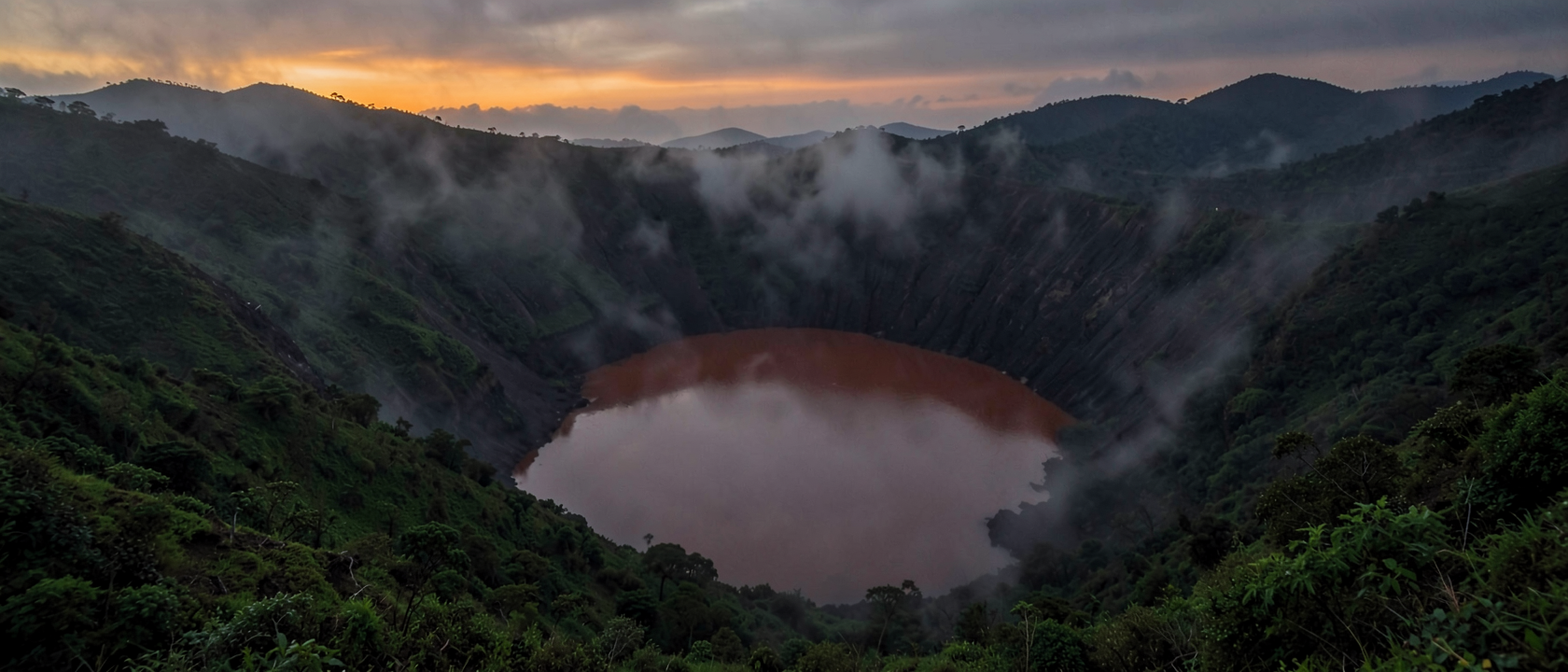
Lake Nyos sits in the Northwest Region of Cameroon inside a volcanic crater. The lake reaches 682 feet (208 meters) at its deepest point. It is one of an estimated 44 crater lakes scattered across the region, all of them above the same active volcanic geology.
From fissures beneath the lake floor, volcanic CO₂ seeps continuously upward into the cold water at the bottom. At that depth, pressure runs at roughly 20 times what it is at the surface, and cold water under that pressure can hold approximately 20 times more dissolved CO₂ than surface water can. The accumulation leaves no mark at the surface. A lake can load this way for decades, or longer, with nothing visible to show what is building below.
The category of hazard was not entirely unknown before 1986. On August 15, 1984, Lake Monoun, approximately 62 miles (100 kilometers) southeast of Lake Nyos, had released a CO₂ cloud that killed 37 people. The Cameroonian government largely kept the event quiet, and the scientific paper identifying its cause had not yet been widely accepted. Two years later, Lake Nyos discharged on an incomparably larger scale.
August 21, 1986: The Feedback Loop
Around 9:30 p.m. on August 21, 1986, witnesses reported a rumbling sound lasting roughly 15 to 20 seconds. What followed happened faster than any warning could have traveled.
What set the deep water moving is not settled. The candidates include a small seismic tremor, wind-driven surface sloshing, a steam explosion beneath the lake floor, or an underwater landslide. None has been confirmed. What is documented is what happened once the water began to rise: a self-reinforcing cycle. Water moving upward into lower pressure released dissolved CO₂ as bubbles. Those bubbles dragged more deep water upward. More water meant more gas, and more gas drove yet more water up. The process accelerated exponentially.
Approximately one quarter of a cubic mile of CO₂ discharged from the lake. The gas, roughly one and a half times denser than air at the temperature it emerged, did not rise and disperse. It flowed downhill, hugging the ground, pushing oxygen out of its path. The cloud traveled down surrounding slopes at roughly 45 miles per hour (72 kilometers per hour). In the villages below, people and animals had no time to respond.
The Bill
The United Nations counted 1,746 dead. At least 300 people were hospitalized. Approximately 3,000 were driven from their homes. An estimated 3,500 cattle were killed, along with birds and insects across the affected zone.
The town of Nyos was not merely damaged. By most accounts, survivors numbered four out of its entire population, though figures differ depending on which sub-village is counted. The surrounding communities lost, in a few hours on a single night, the population and economic base that had taken generations to build. Fields and structures remained. Nearly everyone who had worked them was gone.
What Was Not Resolved
Four decades on, the trigger remains unconfirmed. Scientists have not reached consensus on what set the deep water moving on August 21, 1986, and the competing hypotheses, while narrowed, have not been eliminated.
A controlled degassing system was installed at Lake Nyos: a test pipe in 1995, a permanent installation in January 2001, and two additional larger-diameter pipes in 2011. By approximately 2005, the system had reduced dissolved CO₂ in the lake by an estimated 12 to 14 percent. Whether that reduction, and the pipes added since, are sufficient to prevent a recurrence has not been formally established.
The roughly 44 other crater lakes in Cameroon’s Northwest Region sit above the same geology. How much CO₂ any of them may have accumulated is unknown.
Lake Kivu, on the border of Rwanda and the Democratic Republic of the Congo, accumulates both CO₂ and methane from its floor. It is more than 1,000 times larger than Lake Nyos by surface area, and approximately 2 million people live along its shores. The methane component means a release would carry the additional possibility of combustion, methane ignites, CO₂ does not, making a Lake Kivu event categorically different from what happened at Nyos. Whether, or when, that might occur is a question scientists have not been able to answer with confidence. The first permanent degassing pipe at Lake Nyos was funded by a $433,000 grant secured in 1999 from the U.S. Office of Foreign Disaster Assistance, and assembled by a small international team. Lake Kivu operates at an entirely different scale of both risk and complexity.